The Hayward Fault: Maps & Tours
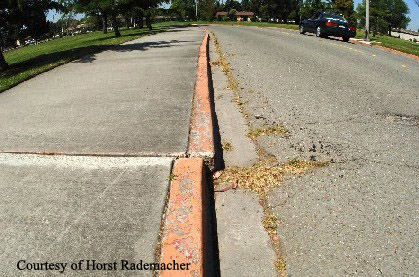
Creep
The fault is slowly moving, resulting in offset of structures like this curb.
The Hayward fault is an extremely interesting feature of the East Bay and you can see its footprints all over the place once you know where and how to look. There are many easy tours you can take to get a closer look at this subterranean beast, as well as maps to find out how close you live to the fault and what seismic hazards—such as landslides or liquefaction—exist near you.
The Hayward Fault on the UC Berkeley Campus
Geophysicist and author Horst Rademacher has written this guide to a brief walking tour of the Hayward Fault on the UC Berkeley campus:
- The Hayward Fault at the Campus of the University of California, Berkeley (e-book)
- The Hayward Fault at the Campus of the University of California, Berkeley (PDF)
Other Tours
The USGS has made a virtual tour using Google Earth. You can look at numerous pictures along the fault as well as view the actual fault path, all with beautiful satellite images! You can also find maps of the fault path without having to use Google Earth.
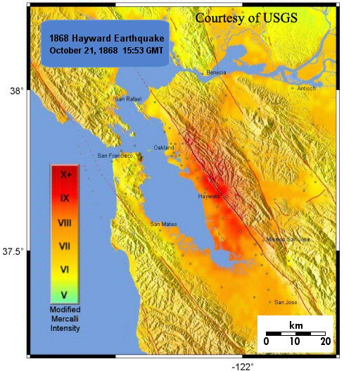
1868 Intensity Map
A shaking intensity map for the 1868 Hayward fault earthquake. USGS
For those interested in more information on the famous 1868 Hayward fault earthquake, the USGS has great information about this event. Take a virtual tour with Google Earth to explore what the East Bay looked like in 1868 and what the damage was like. You can also view a shake map for the event and see how severe the earthquake was in different parts of the Bay Area.
Maps
Along with great virtual tours, the USGS has many wonderful sets of maps of the Bay Area that show different aspects of living in such a tectonically active area. Click the link below to look at different faults in the Bay area as well as other neat maps of the Bay!
The Hayward Fault
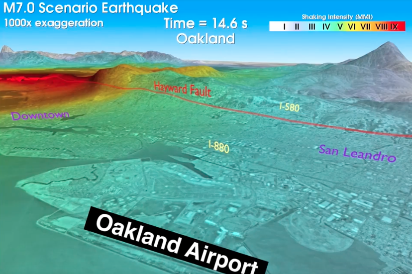
What if...
Learn more at outsmartdisaster.com
A 7.0 earthquake hit the San Francisco Bay Area? Are you, your family, and your business prepared to outsmart disaster?