A Local Event
This example illustrates waveforms from a small local earthquake. This event occurred in the city of Berkeley, CA (just a few kilometers from the Berkeley Seismographic Station!) and was felt throughout the San Francisco Bay area from Santa Rosa to San Jose, and east to Concord. Some minor damage was reported in the East Bay, including broken glass at one Berkeley market.
| Information from the UCB & USGS Menlo Park | |
| Location: | 4 km North West of Berkeley, CA |
| Date: | 94/06/26 |
| Origin Time (UTC): | 08:42:50.7 |
| Location: | 37.907, -122.315 |
| Depth (km): | 4.2 |
| Magnitude: | 4.4 ML |
A map illustrates the location of this earthquake in the San Francisco Bay Area. The circle denotes the location of the epicenter and the squares indicate the sites of several BDSN seismometers. The solid lines indicate the location of major active faults. Other lines connect the earthquake to the stations shown in this example.
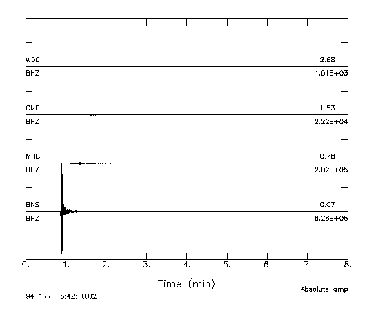
This event occurred on the Hayward Fault system and was well-recorded by all stations of the BDSN. This figure compares recordings from 4 sites on the same plot. These seismograms are plotted with amplitude as a function of time. These are raw waveforms and represent the recorded ground velocity on the vertical component sampled at 20 Hz (the BHZ channel). The traces are ordered by distance and offset by a fixed amount, with the closest station (BKS) at the bottom and the most distant station (WDC) at the top. The traces are plotted with absolute amplitude and the waveforms at BKS dominate the plot. For each station, the distance to the earthquake in degrees is labeled above the trace at the right edge of of the plot, while the maximum amplitude is labeled below. This figure illustrates the dramatic variation of amplitude with distance.
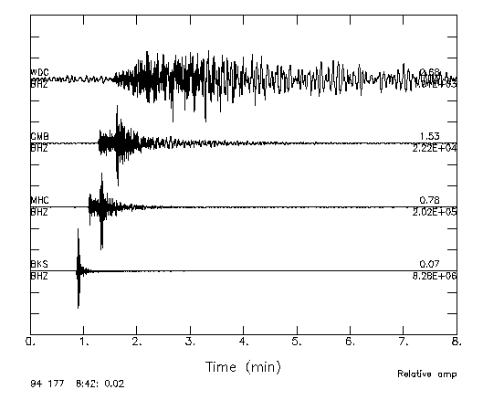
For comparison, this figure shows the same seismograms, with each trace scaled by its own maximum amplitude. This plots allows us to compare the waveforms among the stations. The P-wave is the first arrival on these vertical component seismograms and arrives later as the distance between the earthquake and the station increases. The S-wave is large amplitude phase, arriving after the P-wave. It is quite clear at BKS, MHC, and CMB. At WDC, the S-wave arrival is less clear, due to the emergence of the surface-wave train and local scattering. The difference in the P and S-wave velocities is illustrated by this figure, as the travel time between the P and S wave increases with increasing distance.
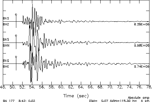
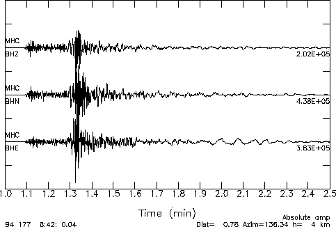
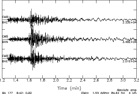
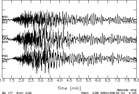
The examples below include plots of the three components of ground motion (BHZ - Vertical, BHN - North, BHE - East) recorded at 4 stations. Each plot shows amplitude as a function of time, although the time scale varies radically from station to station. The "absolute time" of the plot is marked on the lower left, and the tic marks indicate time relative to this absolute time.
| Waveforms from the BDSN | |
BKS
|
|
MHC
|
|
CMB
|
|
WDC
|
|