BRIB - Briones Reservoir
We operate broadband and borehole stations under the network code BK. The Berkeley Digital Seismic Network (BDSN) is a regional network of very broadband and strong motion seismic stations designed to monitor regional seismic activity as well as provide high quality data. The Berkeley borehole stations have borehole geophones or other seismic sensors and may have other geophysical instrumentation.
BARD is our GPS network for monitoring crustal deformation across the Pacific-North America plate boundary and in the San Francisco Bay Area for earthquake hazard reduction studies and rapid earthquake emergency response assessment
| Station Name | BRIB (BRI2) |
| In Operation | 1995/06/23 16:00:00 - Present |
| Latitude | |
| Longitude: | |
| Elevation: | 265.1227 meters |
| Instrumentation | Broadband Borehole GPS Other |
Location
Site is located at the Russell Reservation Field Station of UC Berkeley's College of Natural Resources, adjacent to Briones Regional Park in Orinda, California. This is a collaborative site with instrumentation for the BDSN, HFN, BARD, and the USGS strainmeter networks. This site is known as SFRRL in the USGS network.Network
Berkeley Digital Seismic Network (BK)Northern Hayward Fault Network (BK)
Mini Plate Boundary Observatory Network (BK)
Bay Area Regional Deformation Network Network (BARD)
USGS Low Frequency Network (UL)
Geology
Sandstone
Borehole Conditions
The BRIB site experienced catastrophic flooding in December 2016, destroying the instrumentation and vault. There is not data available/recorded from 2014/12/16 03:00:00 to 2019/09/17 01:20:00. The station was moved to a different area at the same location on 2019/09/17 and re-instrumented.
In early 2019 it was discovered that the BRIB GPS monument at BRIB was very wobbly and the cable conduit from the monument was damaged. Deigo Melgar also reported excess noise levels (see attached displacement and PPSD plots). Data were archived up to 2019/03/19, and then data acquisition and monitoring were turned off until the monument could be structurally restored or completely replaced. Engineers installed a new GNSS site BRI2 on 2019/12/09.
About previous instrumentation:
The instruments are sited in a borehole located on the Russell Reservation. Geophysical instruments are installed at three levels in the 108-meter deep hole. A dilatometer strainmeter, part of the USGS strainmeter network, is installed at the depth of 162 meters. Above the strainmeters, the 6-component HFN package is installed at a depth of 119 meters. The Guralp CMG-3T seismometer of the BDSN is installed at a depth of 35 meters. The FBA-23 is installed at the surface of the borehole. The BARD GPS receiver is located up the hill.On 11/19/1996, the Seismological Laboratory installed a second CMG-3T in a small tank at the surface. Data recording of this sensor replaced the borehole instrument. This site experienced frequent tilts, primarily due to changes in ground water content. In the fall of 2000, BSL engineers installed a post-hole and relocated the Guralp CMG-3T from the borehole to this site. Recording of the post-hole installation began on 12/20/2000. The Guralp in the surface tank has been removed.
GPS Monument Description
Shallow-drilled braced monument in sedimentary bedrock.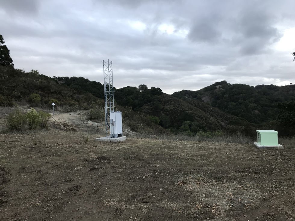
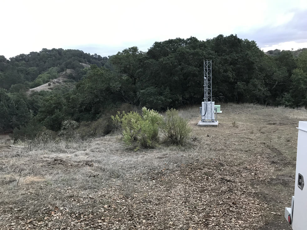
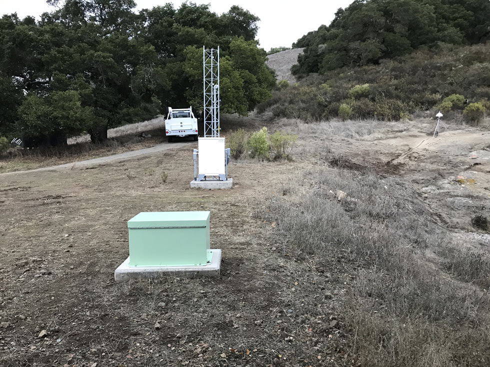
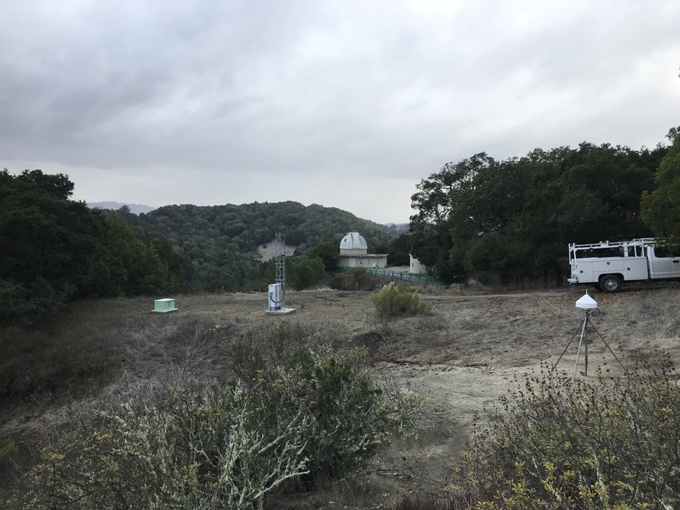
Table of Seismic Instrumentation
| Sensor | Datalogger | SEED Channels | Location | |
| Broadband | MBB-2 | Q8 | BH?,HH?,LH? | 01 |
| Accelerometer | EPISENSOR ES-T | Q8 | HN?,LN? | 01 |
GPS Instrumentation
| Receiver | Antenna | Radome | - | |
| GPS | SEPTENTRIO POLARX5 | SEPTENTRIO SEPCHOKE_B3E6 | SPKE | - |
Waveforms and associated metadata, and GPS data, are available at the Northern California Earthquake Data Center (NCEDC).
Waveform Data
- BK Information Directory, including
- List of station locations
- List of available channels
- Instrument Response
- Querying the archives
- Download waveform data
GPS Data
- Site log: bri2.log
Data Type From To Low-rate raw 08/06/1993 12/8/2006 Low-rate rinex 08/06/1993 present High-rate raw 12/8/2006 present High-rate rinex 5/1/2010 present
Noise Analysis
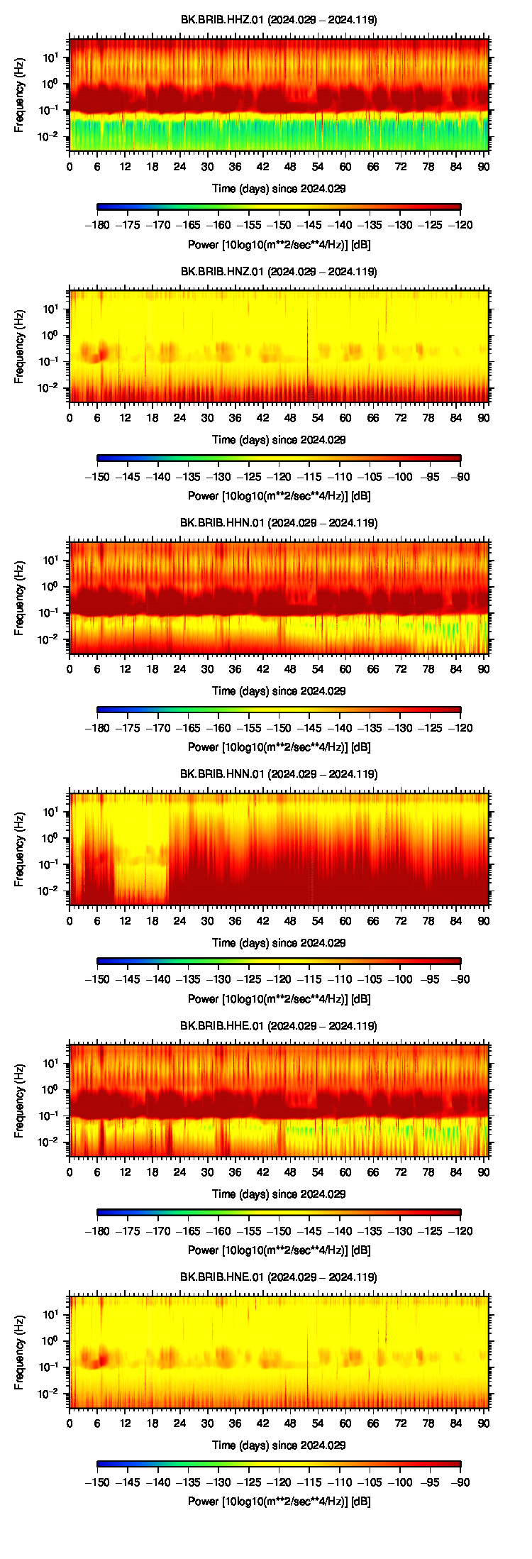 |
GPS Data Quality
Completeness
Data completeness is defined both as "Completeness of observations" and "Cycle slips per observation". "Completeness of Obs." is the number of epochs in the final RINEX file normalized to the expected number. This percentage will go down if time is missing from the RINEX file. "Cycle slips per Obs." is the total number of detected cycle slip normalized to the total number of observations in the RINEX file. This number will increase as the receiver loses lock on satellites more frequently.
| Previous Year |
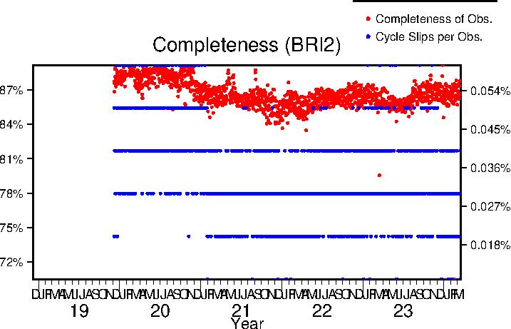 |
| Lifetime |
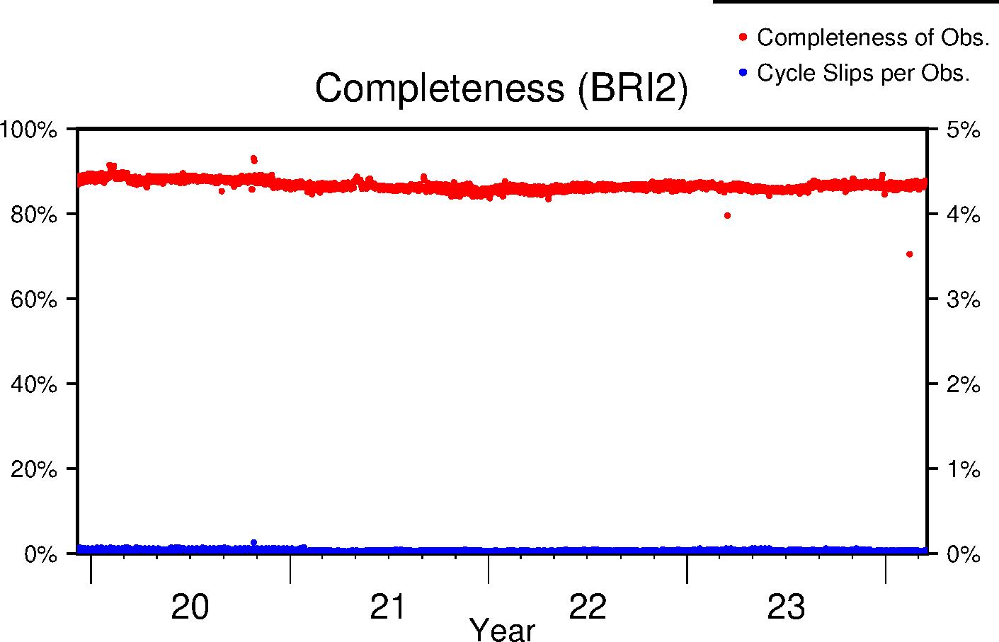 |
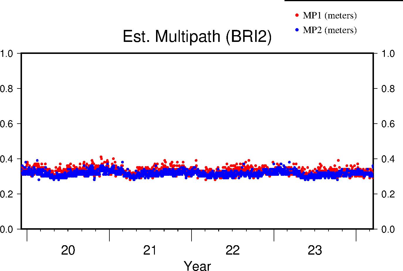
Multipath
The effects of multipath on the data are estimated by parameters for L1 and L2 (MP1 and MP2 respectively); see Estey and Meertens (GPS Solutions, 1999) for derivation. The daily value is the RMS of MP1 and MP2 throughout the day and for all satellites. Higher values indicate a greater prevalence and/or strength of multipathing, i.e. objects on the ground are providing multiple reflection pathways from the satellite to antenna.
| Previous Year |
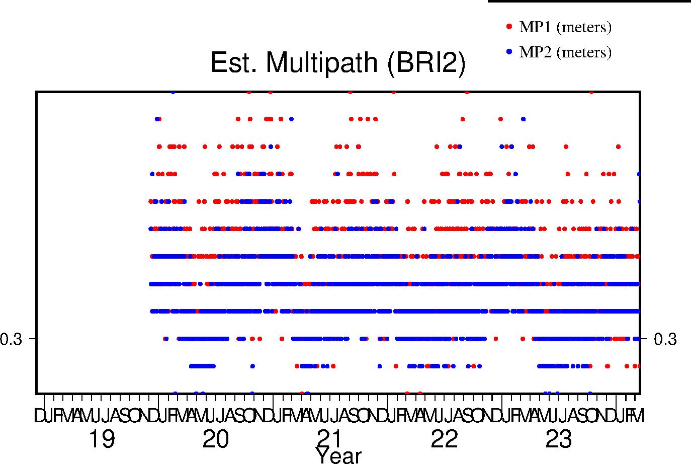 |
| Lifetime |
 |
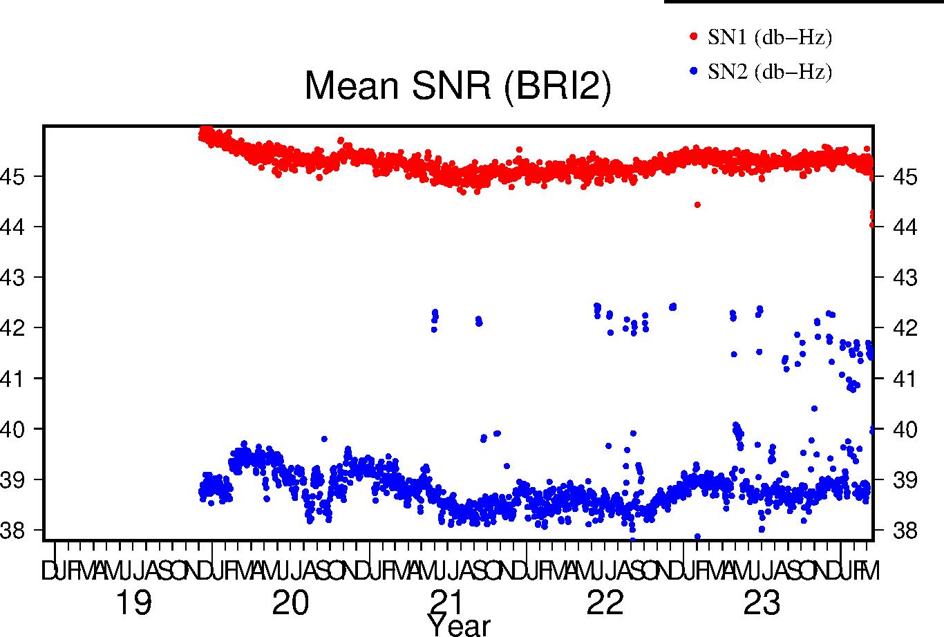
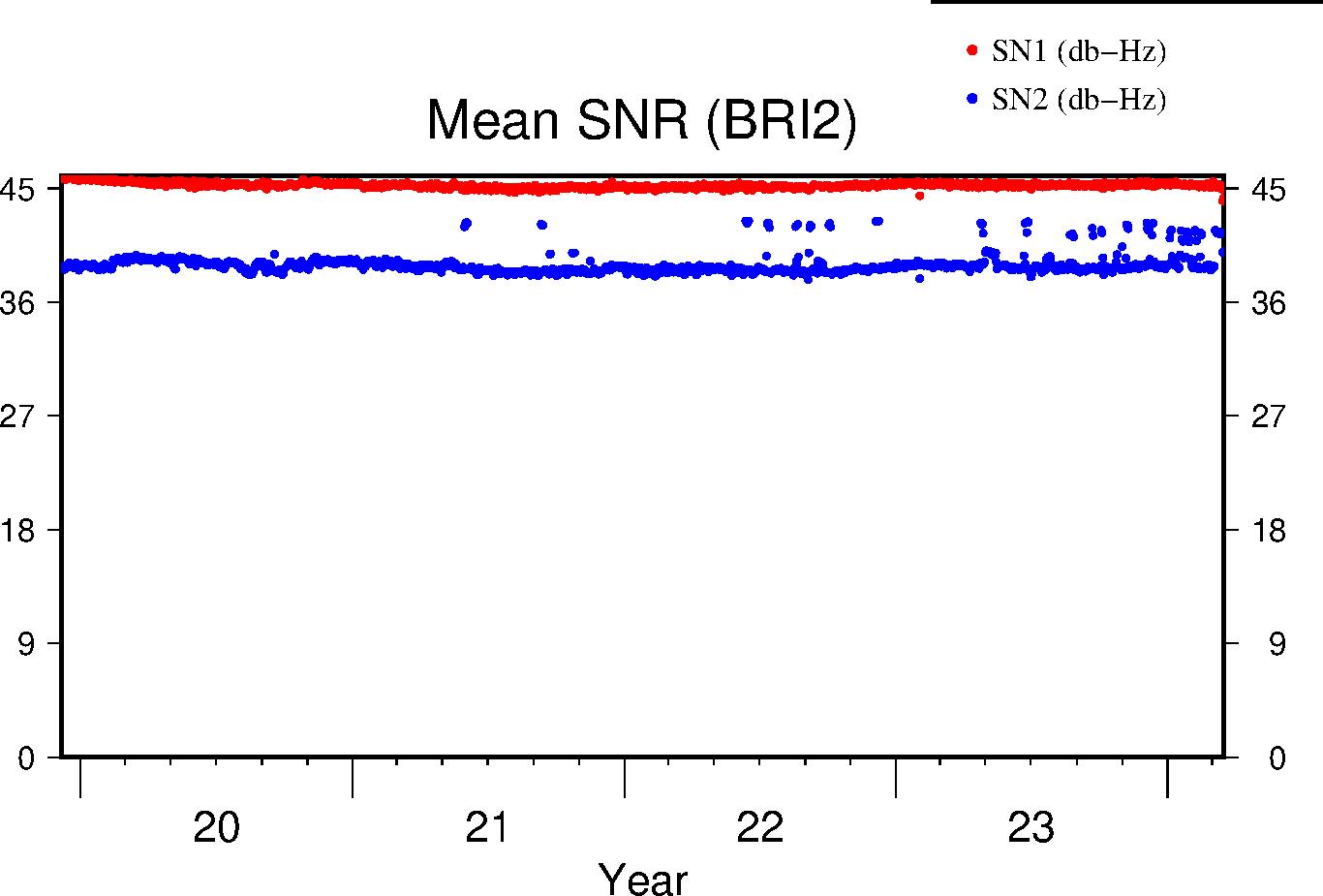
Signal-to-Noise Ratio
The Signal-to-Noise ratios are the mean values above the QC elevation mask for L1 and L2 respectively.
| Previous Year |
 |
| Lifetime |
 |
