|
Project Summary: |
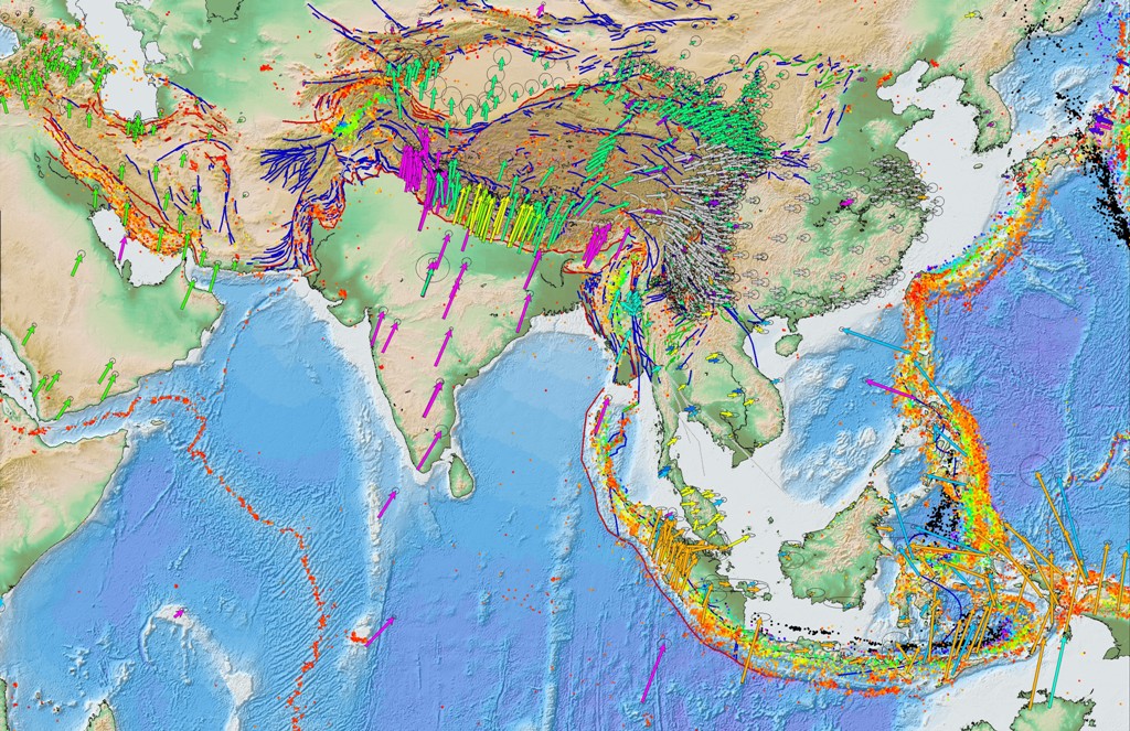
We use 1867 GPS-measured velocities to geodetically
constrain Indian plate motion and intra-plate strain to
examine plate boundary deformation and plate interactions
around the Indian plate. Our solution includes 14
GPS velocities from continuously recording stations from
within the stable Indian plate interior which are used
to estimate the rotation parameters of the Indian plate.
These refined plate motions estimates allow for the rigorous
analysis of the India-Eurasia convergence zone where
we estimate convergence to be 5-10% higher than previous
geodetic estimates (e.g., Paul et al., 2001; 2002; Socquet
et al., 2006a; Bettinelli et al., 2006). Dense station
coverage along the Himalayan range front allows us rigorously
test boundary parameterizations and develop a preferred
plate boundary model. In our preferred model the
Himalayan range front accumulates ~50% of the India-
Eurasia convergence with as much as 25 mm/yr of slip
accumulation along some segments.
|
|
|
Publications: |
Apel, E., R. Bürgmann, P. Bannerjee, and B. Nagarajan,
Geodetically constrained Indian Plate motion and implications for plate boundary deformation, Eos Trans. AGU, 85(52), Fall Meeting Supplement, T51B-1524, 2006.
|
|
|
Tools: |
GPS Geodesy, Elastic Block Modeling |
|
|
Links: |
AGU Poster 2006 [PDF - 8.1 MB],
GPS Velocity Compilation Figure [PDF - 6.1 MB] |
|
|
Geographic Location: |
India |
|
|
Project Duration: |
2005-Current |
|
|
Group Members Involved: |
Edwin (Trey) Apel, Roland Bürgmann, and Paramesh Banerjee (Wadia Institute of Himalayan Geology) |