
|
|
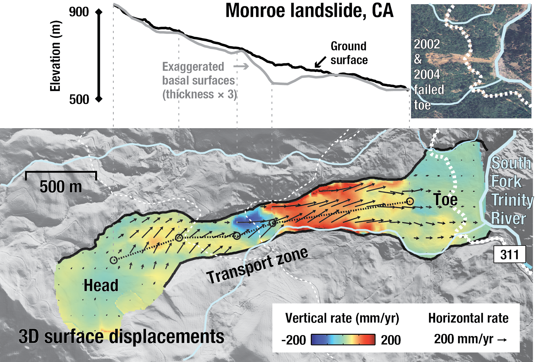
Inferred basal surfaces and 3D displacements of the Monroe landslide.
| Project Summary |
Here we use L-band ALOS-1 and ALOS-2 InSAR observations, to characterize the geometry and the spatio-temporal deformation of the slow-moving, deep-seated Monroe landslide in northern California between 2007 and 2017. InSAR phase discontinuities show that the landslide is bounded by discrete strike-slip faults at the lateral margins, and segregated into distinct kinematic elements by normal and thrust faults. We find that the Monroe landslide has been moving consistently, with a maximum rate of about 0.7 m/yr in the narrowest longitudinal center of the transport zone. The thickest landslide mass is estimated to be in a zone located between subsiding and the uplifting kinematic elements at the lower transport zone. The timing and magnitude of the landslide displacement are modulated by the intensity and duration of precipitation, as well as the antecedent water content of the landslide mass. In addition, we use a one-dimensional pore-water pressure diffusion model to estimate the rainfall-modulated pore-water pressure changes and hydraulic diffusivity. We find hydraulic diffusivity ~6.8×10⁻⁵ m2/s, which agrees with ground-based measurements in this region. Displacement measurements on the hillslopes obtained from geodetic InSAR observations allow us to characterize the mobility, depth, and hydraulic diffusivity of slow-moving landslides.
|
| Tools | ALOS-1 and ALOS-2 InSAR, LiDAR DEM |
| Geographic Location | South Fork Trinity River, California |
| Group Members Involved |
Xie Hu <Email> <Personal Web Site> Roland Bürgmann Zhong Lu |
| Project Duration | 2017 - 2019 |
| More Information | JGR article < Hu et al., 2019 > |