
|
|
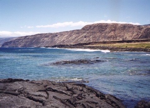
The steep fault scarp of the Hilina Pali rises out of the Pacific ocean near Kilauea Volcano.
| Project Summary |
This project provides a detailed paleoseismic analysis of the Hilina Fault System on the south flank of Kilauea Volcano, Hawaii, that improves geologic hazard assessment in the region.
Geologic hazards of the south flank region include large seismic events, volcanic activity, and tsunami waves resulting from seismic or volcanic events. This paleoseismic study
focuses on paleoseismology correlating historical surface faulting with previous seismic events. Our initial investigation focuses on fault displacement analysis of the 1975
Kalapana earthquake. We created a detailed fault rupture map of the south flank, consisting of rupture traces and displacement measurements associated
with the 1975 Kalapana earthquake. Further paleoseismic investigations will establish recurrence intervals for major south flank earthquakes, map and quantify earthquake
displacements previous to the 1975 Kalapana event, and estimate displacement rates for the south flank region.
|
| Tools | Real-time Kinematic GPS, Hiking Boots |
| Geographic Location | South flank of Kilauea Volcano, Hawaii Volcanoes National Park, Hawaii |
| Group Members Involved |
Eric Cannon (University of Colorado) Matthew d'Alessio <Email> <Personal Web Site> Roland Bürgmann |
| Project Duration | 1998 - 2000 |
| More Information | < M.S. Thesis of Eric Cannon > |