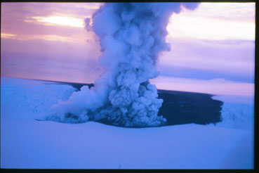
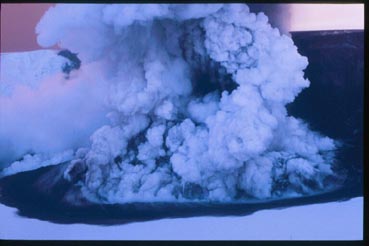
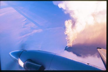
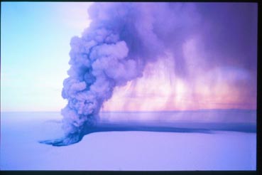
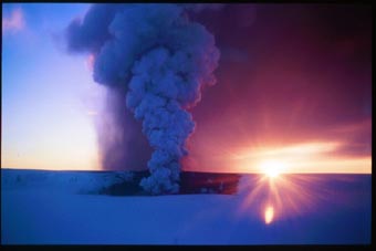
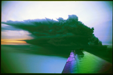
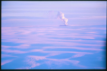
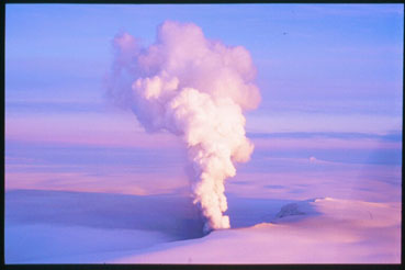
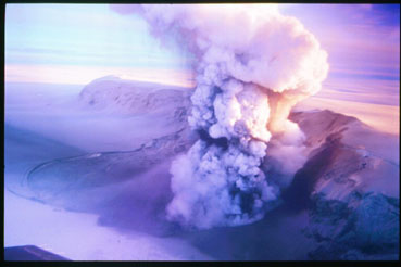
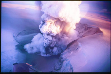
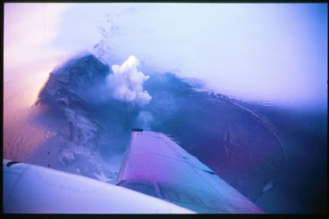
18 December 1998 - Day 1 of the Eruption
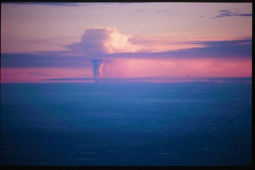
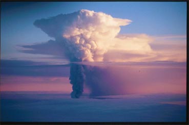
The eruption began at 9:20 AM, as witnessed by the onset of a continuous eruption tremor recorded by seismographs, and ten minutes later an eruption plume was observed. Photographs show the plume from various distances, up to 200 km (the first image), from 11:20 AM until 12:50 PM. The plume was continuous and extended to elevation of 10 km (32000 feet), loaded with tephra. The plume was deflected to the SE, by mild westerly winds. The eruption occurred at the southern edge of the Grímsvötn caldera, at the foot of Mt. Grímsfjall (which rises about 300 m above the flat ice shelf of the Grímsvötn subglacial lake). The eruption penetrated through the Grímsvötn subglacial caldera lake and its ice shelf, from ice/water depth of about 100 meters. The eruptive fissure was about 1300 m long, east-west directed, along the Grímsvötn caldera fault. Activity was most vigorous at one crater, but several other craters on the short eruptive fissure were also active with less frequent explosions. Last image gives a good overview over the eruptive site. It is taken from elevation of 10 km, near the top of the eruption plume, and gives a view towards the NE. It shows the location of the eruptive site at the southern boundary of the Grímsvötn caldera, the tephra sector towards the SE, the northern boundary of the Grímsvötn caldera, and ice cauldrons over the 1996 Gjálp eruptive site, north of Grímsvötn. The width of the Grímsvötn caldera is about 10 km.
19 December 1998 - Day 2 of the Eruption
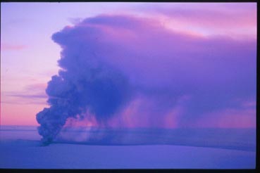
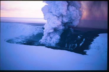
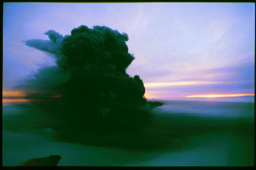
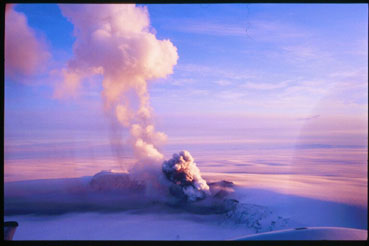
The eruption was slightly less vigorous than on 18th of December. The eruption plume was continuous, but somewhat lower than the day before, extending to an elevation of 7-8 km height (23000 -27000 feet). Photographs show the eruption between 10:30 AM and 12:30 PM. Tephra continued to fall towards the SE. A small part of the Grímsvötn ice shelf, next to the eruption site, had melted, without raising the water level of the Grímsvötn caldera lake significantly. Activity was mostly limited to one crater.
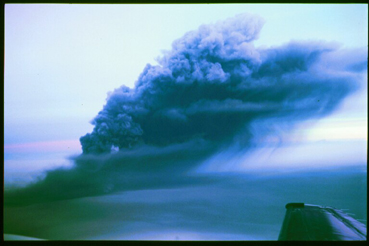
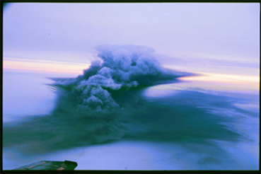
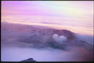
20 December 1998 - Day 3 of the Eruption
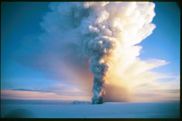
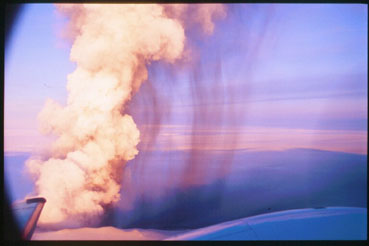
Flight over the eruptive site between 10:45 AM and
12:15 PM revealed variable activity. Eruption plume extended highest
to 7 km elevation (22000 feet). Initially the plume was rater light
colored, and narrow at its base. The eruptive site and Mt. Grímsfjall
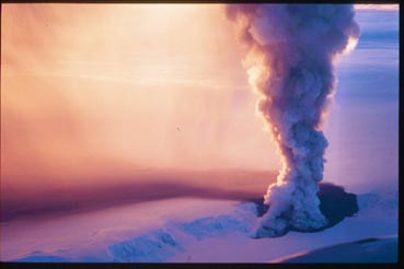
could be clearly seen (first image). Later the ash content of the
plume greatly increased, and the plume turned black. It collapsed
(become lower) by several thousands feet (1-2 km), created a base surge,
and Mt. Grímsfjall disappeared into an ash cloud.
27 December 1998 - Day 10 of the Eruption
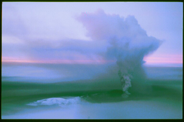
This was the second last day of the eruption, it ended on December 28. Photographs show intermittent eruptive activity between 11:24 AM and 12:40 PM. The eruption plume was discontinuous, fed by intermittent activity in the crater. It rose highest to about 4.5 km elevation (15000 feet), but disappeared in-between. The plume distributed ash in the near vicinity of the crater, and ejected bombs, up to 0.5 m in diameter onto Grímsfjall. Intervals of low activity allowed good visibility towards the active crater, and the water pond NE of the eruptive site, formed by melting of the Grímsvötn ice shelf. Although not clear from the photographs shown here, the eruption has resulted in the formation of a tephra ring that lies partly on ice, but its inner part is likely to be made completely of ash overlying bedrock in the Grímsvötn depression. It is likely to consolidate into a tuff ring, which may eventually exist as a nunatak in the ice cap.
Photos taken by Freysteinn Sigmundsson
![]()