
The Alum
Rock Earthquake of October 30, 2007, 08:04 pm PDT
A strong
earthquake shook the Bay area at 08:04
pm PDT on October 30, 2007 (03:04 UTC on October 31, 2007). Its was
located about 8 miles NNE of Alum Rock, CA at depth of 6 miles on the Calaveras
Fault. According to researchers at the Berkeley Seismological Laboratory the
earthquake had a moment magnitude of 5.4
(Figure 1). The event led to strong shaking in the epicentral
region (Figure 2). Felt reports were entered from beyond Santa Rosa to the NW, the Sierras to the E
and King City to the S (Figure 3).
The earthquake
occured on the Calaveras fault.
During this earthquake the fault ruptured for about 3 miles toward the SE from
the hypocenter. This kind of movement is typical
for earthquakes in our region.
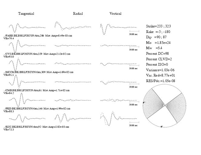
Figure 1: Moment tensor results for the Alum Rock
earthquake of October 30, 2007. For this
solution, stations from more than 50 km (30 miles) were used. The fits are very
good and the mechanism is consistent with the right lateral movement along the
Calaveras Fault.
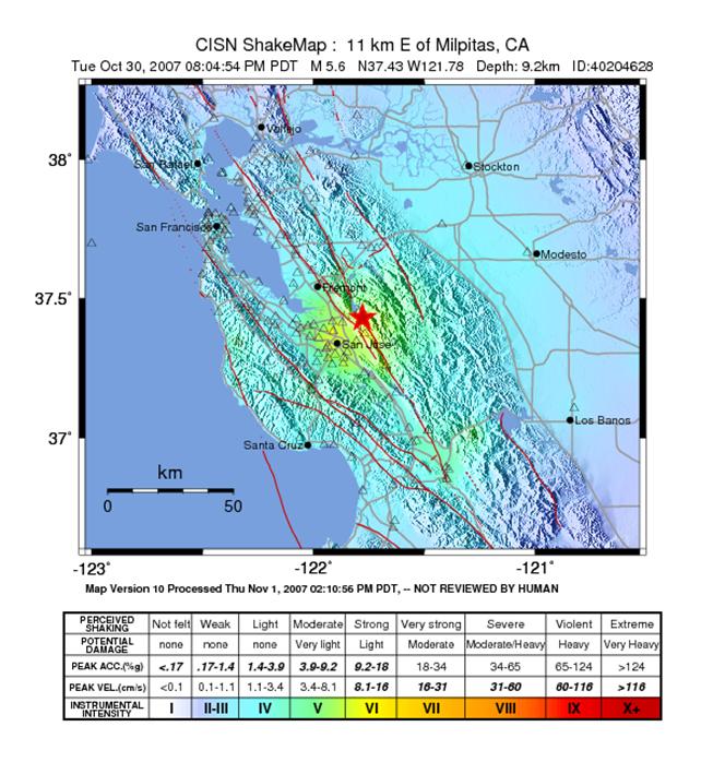
Figure 2: Shakemap intensity map for the Alum Rock
earthquake of October 30, 2007. Note that the shaking was strong in the epicentral
region. There is some evidence of rupture directivity. Shaking was felt
throughout the Bay Area and the Central California region of the Central Valley.
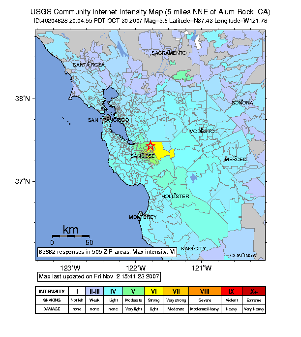
Figure 3: Community Internet
Intensity Map for the October 30, 2007, Alum Rock
earthquake. This assessment of shaking in each area is compiled from internet
reports of the residents. People who felt the earthquake are encouraged to
report their observations on the web by pointing their browsers to
http://pasadena.wr.usgs.gov/shake/STORE/X40204628/ciim_form.html
The Berkeley Seismological Laboratory at the University
of California has been monitoring the
seismic activity in Northern California since
1886. Together with the United States Geological Survey (USGS) and the
California Institute of Technology (Caltech) in Pasadena,
Berkeley
currently operates the California Integrated Seismic Network.