The Berkeley Seismological Laboratory conducts essential research on earthquakes and solid earth processes while collecting and delivering high quality geophysical data..
We provide robust earthquake and hazard information including real-time alerts to the public, in collaboration with our partners.
We enable the broad consumption of earthquake information by everyone while educating and training students at all levels and from all backgrounds.

Dr. Weiqiang Zhu is the 2025 recipient of the Charles F. Richter Early Career Award
Weiqiang Zhu, an assistant professor at the University of California, Berkeley, has been honored with the 2025 Charles F. Richter Early Career Award for his contributions to AI-based approaches to earthquake monitoring, numerical modeling and inverse problems that have pushed the frontier of seismological research.
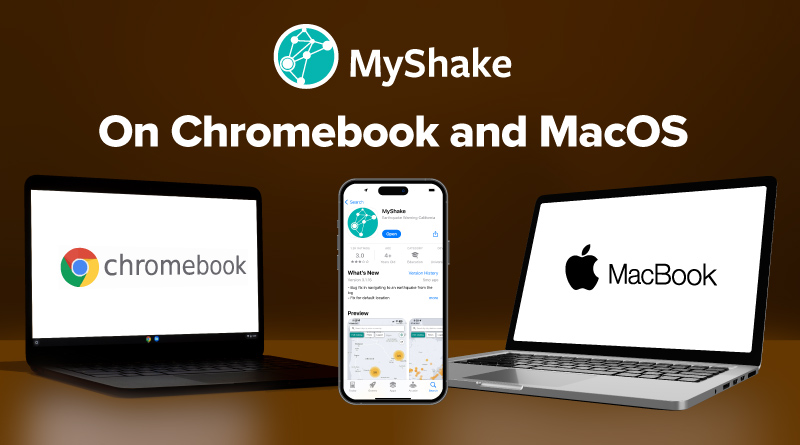
Cal OES and UC Berkeley Announce New MyShake Tools for Early Earthquake Notification
Following two major earthquakes that shook California during the last two weeks, the California Governor’s Office of Emergency Services (Cal OES) and UC Berkeley Seismology Lab announce that the first-in-the-nation statewide earthquake early warning phone app, known as “MyShake,” is now available for download at no cost for Chromebooks and MacOS.
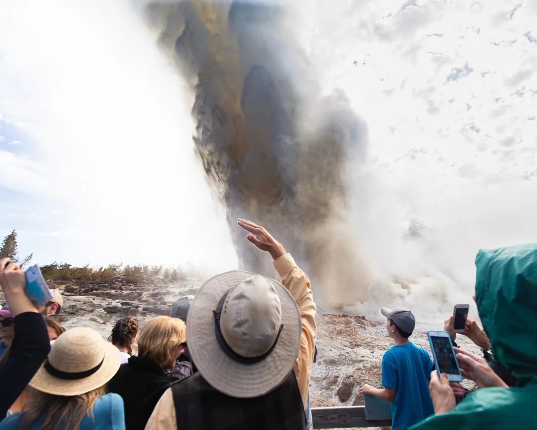
When Steamboat goes WHOOSH, scientists look for answers
Steamboat is the world’s tallest active geyser, but unlike Old Faithful, its eruptions are completely unpredictable. Now, a new analysis suggests that at least one recent Steamboat eruption got triggered by a small earthquake.

The Great Berkeley ShakeOut & Preparedness Block Party & Drill
Ready for the next big earthquake? Practice your Drop (or Lock), Cover, and Hold on this ShakeOut at 10:17 am on October 17 and come see what all that practice is for with...

Workshop in honor of Doug Dreger's retirement: BSL Sept 20th, 2024
On September 20th, 2-5:30 pm, BSL is holding a workshop in honor of Professor Doug Dreger, Associate Director of BSL, who retired this summer. The workshop will be held in the BSL Conference Room (220 McCone) and will feature presentations by some of Doug's former students and collaborators.The program is available and you are invited to join us. We encourage you to join the seminar in person in 220 McCone Hall, but you can join remotely (after logging into your zoom account) via https://berkeley.zoom.us/j/98335211649.

Seismic station on remote Farallon Islands gets critical upgrade
In late January, seven engineers from the Berkeley Seismological Laboratory helicoptered into the Farallon Islands, a windswept, nearly treeless chain of islands 30 miles off San Francisco's Golden Gate, on an eight-day...