Seismo Blog
Earthquake Early Warning is Finally Here
Categories: Earthquake Early Warning
October 17, 2019
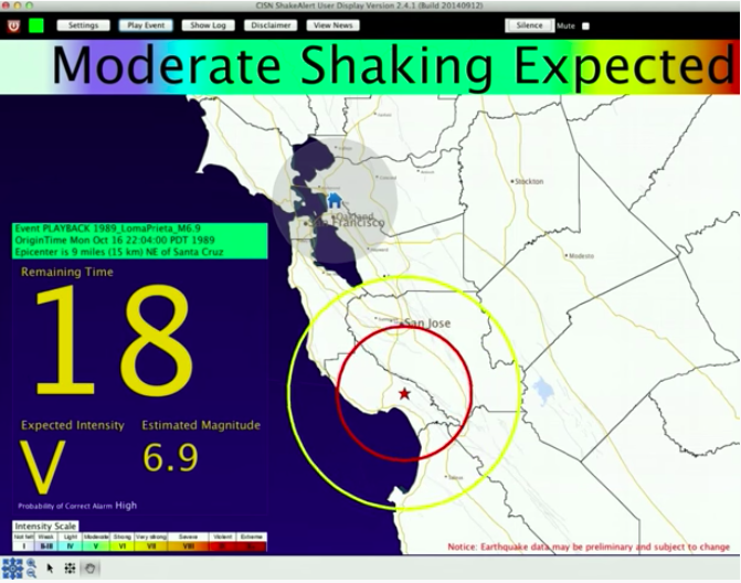
It has been several years since the first prototype of an earthquake early warning (EEW) system for the US West Coast proved to be working successfully: A few seconds before the seismic waves of the South Napa Earthquake reached the densely populated San Francisco Bay Area on August 24, 2014, the warning system sounded an alert, albeit only to a few test users. In fact, earlier test versions of this system had been around since 2012 (see blog entry 2 Oct 2012). Readers of this blog may rightly ask why it took more than seven years before this potentially life saving system, dubbed ShakeAlert™, was rolled out to the general public in California only today - beyond its few beta-testers like BART and others. (See blog entry 28 Sep 2012). The answer to this question is almost as complex as the numerical algorithms, which are at the core of any earthquake warning system.
There are, of course, lots of technical reasons before any prototype can go live into the mainstream. Bugs in computer codes have to be ironed out, data flow processes have to be streamlined and the density of seismic stations in California has to be increased substantially. While a decade ago the seismic network in northern California consisted of about 100 stations which were ready for earthquake early warning, we now have approximately 280 seismic sensors contributing to the system. And more stations are being added over the next few years. The reason for the densification: A seismic network optimized for earthquake early warning needs to detect a temblor as soon as possible after its rupture starts. The closer the earthquake sensors are to a potential source, the earlier they can detect the first sign of rumblings. And a gain of even a few seconds in early detection translates to an improved warning time for the public.
Then there is an important legal question underlying any warning of an impending natural disaster: Who shall issue a public alert which may substantially interrupt public life? Over the past decade researchers and engineers at UC Berkeley's Seismological Laboratory (BSL) and at its counterpart at the California Institute of Technology in Pasadena were the main drivers in developing and realizing ShakeAlert. Despite all their knowledge and expertise, they have no legal authority to warn the public. This is clearly a function of the government, similar to issuing severe weather alerts. It is the federal government through the National Weather Service and the National Oceanic and Atmospheric Administration, which issues public alerts for hurricanes, tornadoes, tsunamis and other potentially devastating natural events. Hence, both California's Office of Emergency Services (CalOES) and the United State Geological Survey (USGS) had to be involved, with the USGS, a federal agency, taking the lead in issuing the alerts for earthquake shaking.
While it took some time to resolve all these technical and legal issues, there is still a fundamental open question: How does an earthquake early warning alert reach hundreds of thousands of people within a few seconds? Other countries with similar systems have long solved this problem of alert dissemination. Mexico relies on warning sirens in public places and radio messages. In Japan, alerts flash as banner headlines across TV screens, computers deliver messages received via the internet, cell phones beep and in the Tokyo subway and on other rail lines, monitors show the alerts.
For its warning dissemination ShakeAlert will rely on the fact that smart phones have become ubiquitous in every day life. Earlier this year the city of Los Angeles made the first smart phone app available to disseminate EEW alerts publicly. However, this release was specifically geared to and hence limited to the city and county of LA. During the official statewide public roll-out of ShakeAlert for California today Governor Gavin Newsom also presented an app, which may be used everywhere ShakeAlert is active. This app, MyShake, was developed at the BSL, initially with start-up funding from The Gordon and Betty Moore Foundation, and now supported by CalOES.
MyShake's original purpose is to use the accelerometers built into every smart phone to help detect and locate earthquakes. But this app is more than a means for citizen scientists to participate in seismological research and monitoring. More than 300,000 users worldwide have downloaded this app on their phones, several tens of thousands of them in California. Many of them use the full functionality of MyShake by letting the app record the shaking measured by the phone's accelerometer. Others use only its option to be notified – but not warned – about significant quakes worldwide.
The new option in MyShake enhances this notification pathway. By being fed the alerts coming from the ShakeAlert computers, MyShake can inform its users in California very quickly about the pending shaking. In fact, the median time it took for MyShake to send out alert messages about Monday evening's magnitude 4.5 earthquake in the East Bay was 2.1 seconds. The app works both on Android and iPhone operating systems can be downloaded for free from the various app stores.
But once you have installed the app on your phone, don't expect to get a warning
for all quakes occurring along the US West Coast. Firstly, ShakeAlert is yet not
ready to alert publicly in the states of Oregon and Washington. And even in
California, you will not be burdened by alerts for small quakes far away. You will
only get an alert if the location of your phone is estimated to get noticeable
shaking. These values are calculated by the ShakeAlert algorithms and then sent
to the MyShake server for dissemination. Once you have received an alert,
MyShake allows you to report any damage you see around you. More information
about the ongoing development with MyShake can be found here:
http://myshake.berkeley.edu (hra169)
BSL Blogging Team: Who we are
Recent Posts
-
: Alerts for the Whole West Coast
-
: Destruction in the Eastern Aegean Sea
-
: An Explosion in Beirut heard all over the Middle East
View Posts By Location
Categories
- Alaska (3)
- Bay Area (24)
- Buildings (3)
- Calaveras (4)
- California (13)
- Central California (4)
- Chile (4)
- Earthquake Early Warning (10)
- Earthquake Faults and Faulting (44)
- Earthquake Science (3)
- Haiti (3)
- Hayward (12)
- Indonesia (4)
- Induced Seismicity (3)
- Instrumentation (18)
- Italy (6)
- Japan (7)
- MOBB (3)
- Mendocino Triple Junction (5)
- Mexico (7)
- Nepal (3)
- North Korea (5)
- Nuclear Test (5)
- Ocean Bottom Seismometer (3)
- Oklahoma (4)
- Plate Tectonics (18)
- Preparedness, Risks, and Hazards (15)
- Salton Sea (3)
- San Andreas Fault (14)
- Seismic Waves (13)
- Seismograms (4)
- ShakeAlert (3)
- Southern California (5)
- Surface Waves (3)
- Today in Earthquake History (20)
- Volcanoes (4)
- subduction (3)